I am a pragmatic and personable geospatial developer. I strive to complement my technical skills with an excellence in communicative and collaborative qualities. My training has provided me with a grounding in modern GIS and remote sensing technologies, and my experience in research has given me the analytical abilities inherent in applied research. I am now fully committed to the research of geospatial applications to regional climate change adaptation.
Short - Provide geospatial services in areas of coastal hazards and adaptation planning.
Long - Work to assist the adaptation of coastal populations to projected climatic change using the powerful decision support provided by geospatial technology.
scott.v.hatcher (at) gmail (dot) com
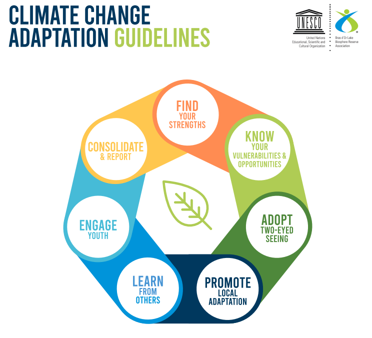
The report builds on the proceedings of the Climate Change Adaptation Forum held in Cape Breton in 2019.
I attended the Climate Change Adaptation Forum in the Bras D'Or Lakes Biosphere Reserve, and was hired by the reserve association to produce a report outlining guidelines for adaptation in Canada's UNESCO Biosphere Reserves. The report can be downloaded from this link
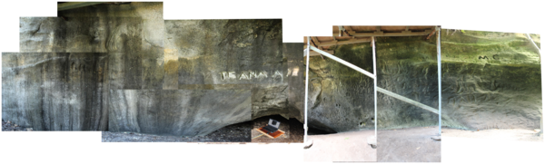
Stitched panorama showing the archaeological rock carving face
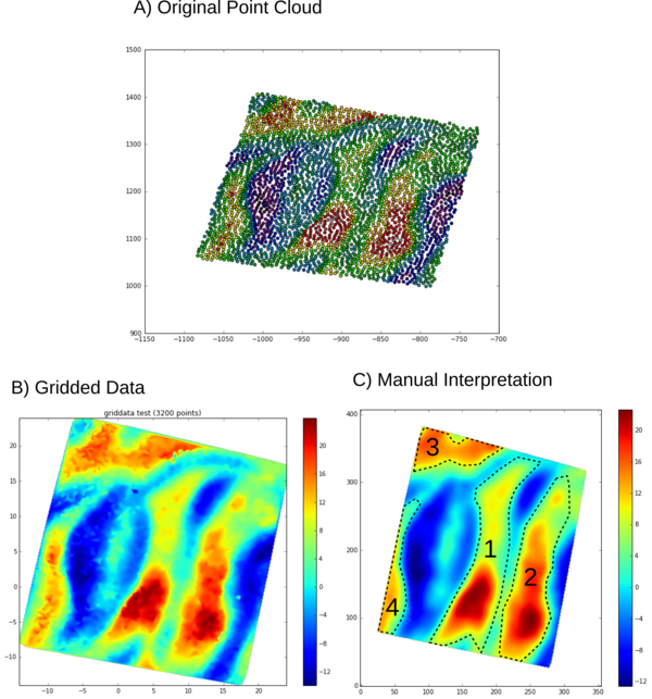
The original data, as well as the manual interpretation of the carvings
Attempts at automatically segmenting the image to follow the carvings
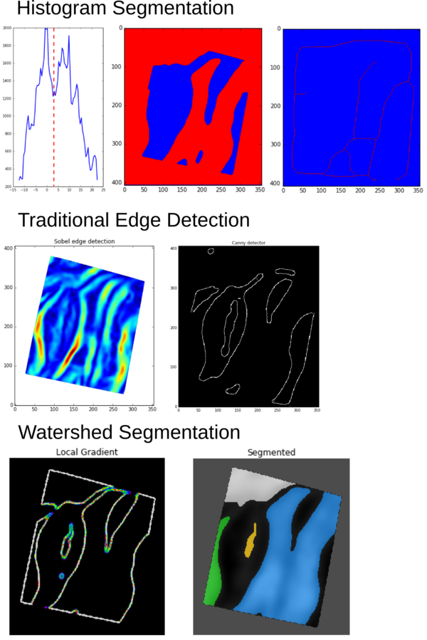
For the purpose of preservation, as well as to facilitate analysis, some rock carvings made on the face of a cave were scanned at very high resolution using a white-light scanner. The carvings are located on the Chatham Islands, which are a group of islands east of New Zealand. This was done by the Archaeology and Surveying departments of the University of Otago in Dunedin, New Zealand. My job was to attempt to automate the process of detecting the carvings from the surveying data in order to quickly map their layout on the carving face.
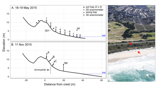
Instrument positions for measuring sand movement over the dune
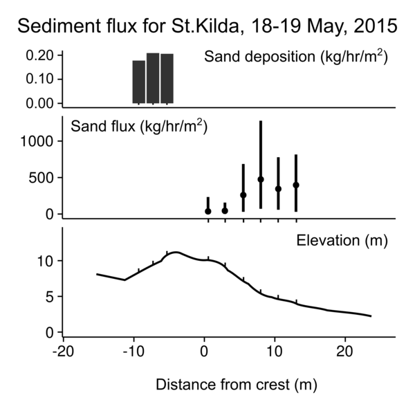
Measured sediment flux in the sand traps
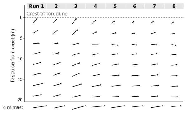
Measured wind velocities and directions over the dune
I was involved in a project that aimed to quantify the effect of highly oblique winds in transporting sand over a coastal dune. This coastal dune, located on the southern coast of Dunedin, New Zealand, is adjacent to municipal lands, and is bordered by a large road made of backfill. The project used in situ measurement techniques to quantify the effects of steering and acceleration of the regional winds due to the local topography of the dune.
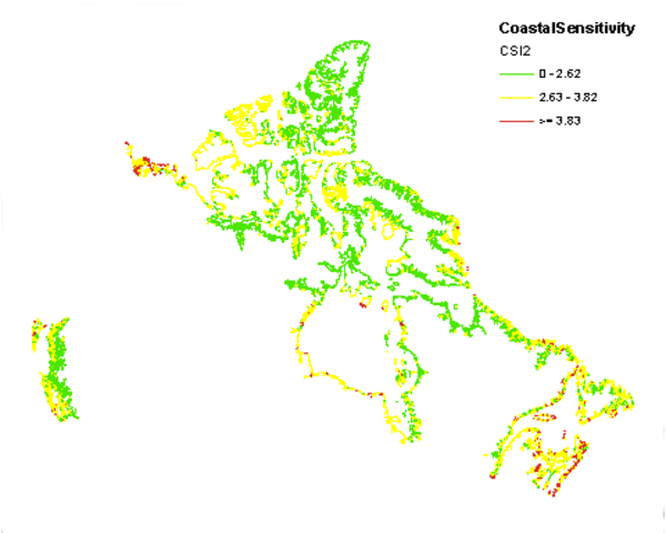
Results of the CanCoast coastal sensitivity index analysis
The goal of the CanCoast project is to improve upon the existing Coastal Vulnerability Index (CVI) from Shaw et.al. (1998) using updated information on Geology, Coastline shape, permafrost, and socioeconomic variables. To do this, a GIS with all relevant layers was created, and then a new formula for calculating a vulnerability index was developed.
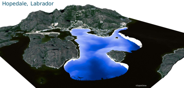
Orthoview of derived DEM and bathymetry for Hopedale, Labrador
The community plans for the Inuit towns within Nunatsiavut, in northern Labrador, rely on planners from Ottawa. This presents challenges when it comes to community assets that are cultural and unmapped. The planners wanted to incorporate this information into community plans, as well as fill in data gaps to do with projected climatic change. A partnership with Memorial University allowed this problem to be tackled.
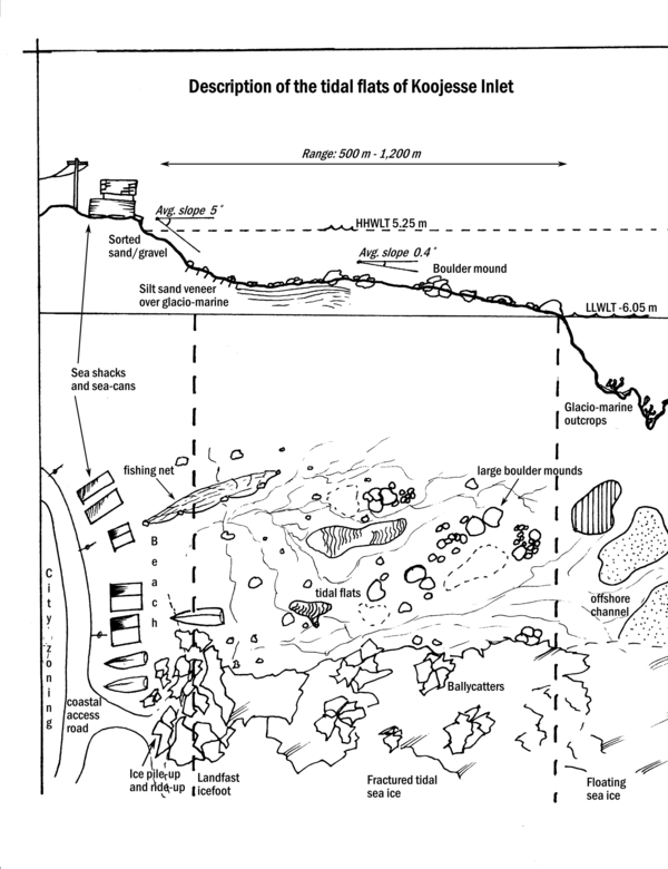
Illustration showing the layout of the Koojesse Inlet tidal flats
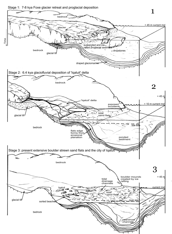
Illustration showing the proposed evolution of the tidal flats
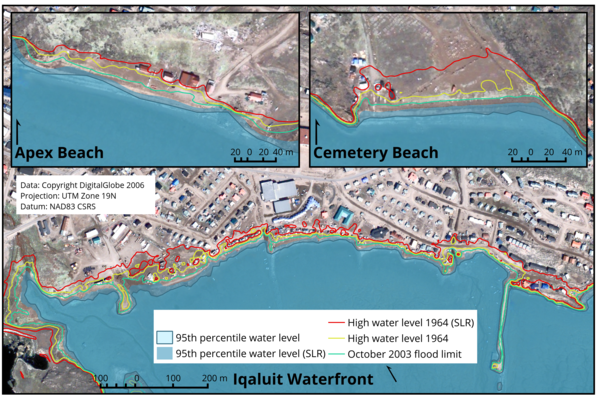
Map showing the incursion of water onto the shoreline of Iqaluit based on projected SLR scenarios
The city of Iqaluit needed an assessment of coastal hazards within Koojesse Inlet, the main inlet servicing the city, in order to incorporate proper planning into its five year plan, as well as it's long-term climate change adaptation plan.

Underwater photogrammetry
As part of my final project I attempted a 3D model of a scuba tank underwater using oblqiue photogrammetry. This is very common place now (structure from motion has advanced rapidly since then), but at the time I had a lot of fun diving into new avenues of photogrammetry.
Hippalus has retained a seat in those remembered from ancient history as a great navigator. It was he who cleverly began sailing due East once leaving the Gulf of Aden and arriving on the Western coast of India, when all others assumed this would be a suicide mission. His fame even gave his name to monsoon winds that made his feat possible. The evidence we have, however, for his existence is faint, but his story could help elucidate the way mythology shaped the ancient Graeco-Roman world.
Lightbox Image
I am an amateur photographer, enjoying taking photos of nature and of funny situations. I keep my portfolio on flickr